


- How to dress to go to the creeks?
- How to access the creek of Marseilleveyre on foot?
- How to access the creek of Marseilleveyre by bike?
- How to access the calanque de Marseilleveyre by car?
- Where to park at the calanque de Marseilleveyre?
- How to access the creek of Marseilleveyre by boat?
- Which creeks to visit in Marseille?
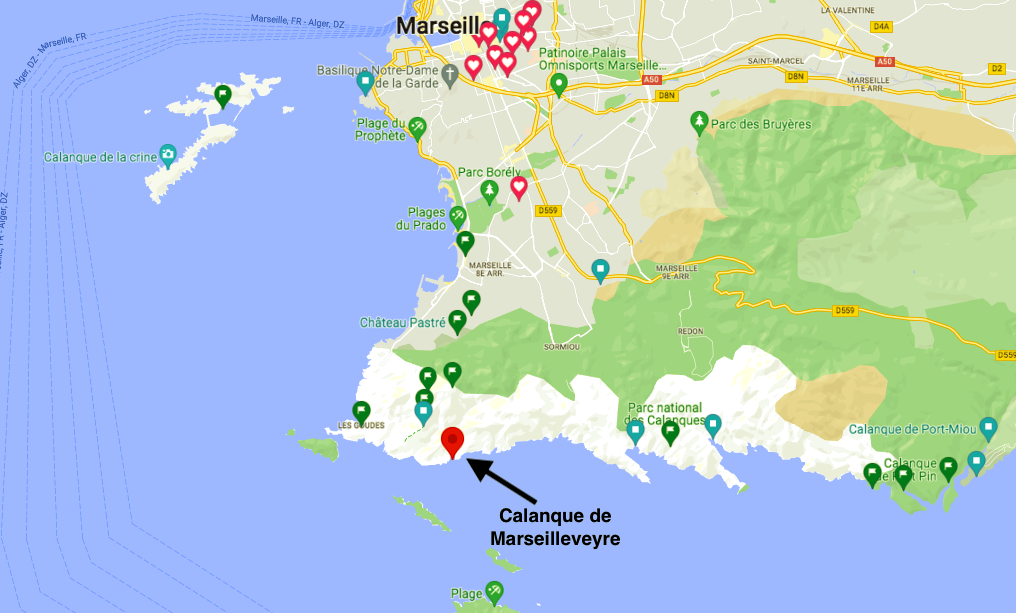
The calanque de Marseilleveyre is one of the closest to Marseille.
Just after the Goudes, Callelongue and the Mouline, the calanque de Marseilleveyre is a first step in the calanques national park.
The calanque de Marseilleveyre is only accessible on foot.
You can access by bus or park by car in Callelongue to start the walk. Indeed, you will have at least 40 minutes on foot to do.
Creek: Marseilleveyre
Duration: To access the creek of Marseilleveyre, count between 45 minutes and 3 hours of walk depending on the path taken.
Routes:
- Passage by the footsteps of the Half-Moon – 1h30
- Passage by the Cross De Marseilleveyre – about 3h
- By the seaside – 45 min
Departure: Callelongue (recommended) / Les Goudes / Montredon (For the Cross of Marseilleveyre)
Where to park:
- Parking Callelongue
- Parking des Goudes
Which bus to Marseilleveyre: Line 19 then 20
More details below.
We give you all the information to discover the calanque of Marseilleveyre
How to dress to go to the creeks?
We give you all the details in the article make the creeks of Marseille.
If in doubt we reshare this information, so plan:
- Water! in summer minimum 1.5 liters per person
- Good shoes (running can be enough)
- Time
- Check the weather
- Hiking poles if needed
- Enough to swim!
- The winning trio: cap, sunglasses and sunscreen
How to access the creek of Marseilleveyre on foot?
To get to the creek of Marseilleveyre, you will absolutely have to walk.
Several options exist to get to this wonderful cove.
First, you will need to access Montredon, les Goudes or Callelongue.
The easiest way is to come by bus.
You can also take the bikes with “Le Vélo” (last stop at the Parc Pastré in Montredon) or the Dott electric bikes.
To access the cove of Marseilleveyre, you have several paths.
We give you the 3 main paths/hikes:
1. By the seaside from Callelongue – about 45 min one way
This is the easiest path because it runs along the seaside.
There are no big difficulties but there may be some narrow passages.
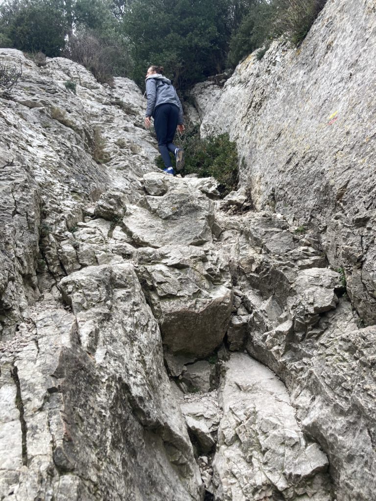
2. By the half-moon step from Callelongue – about 1h30 one way
Attention there are some technical passages including the passage of the half-moon which is a little vertiginous but having a little vertigo we were able to do it without worries.
From Callelongue take a direct left into the village along the restaurant and then the raised petanque court which will be on your left. At the end of the street you will have a wooden barrier that must be passed.
Walk in less than 5 minutes then on the right you will have a climb with a markup you can not miss the climb is very wide.
The ascent takes about 30 minutes taking breaks but it is well worth it. Always follow the markings, the path is well signposted.
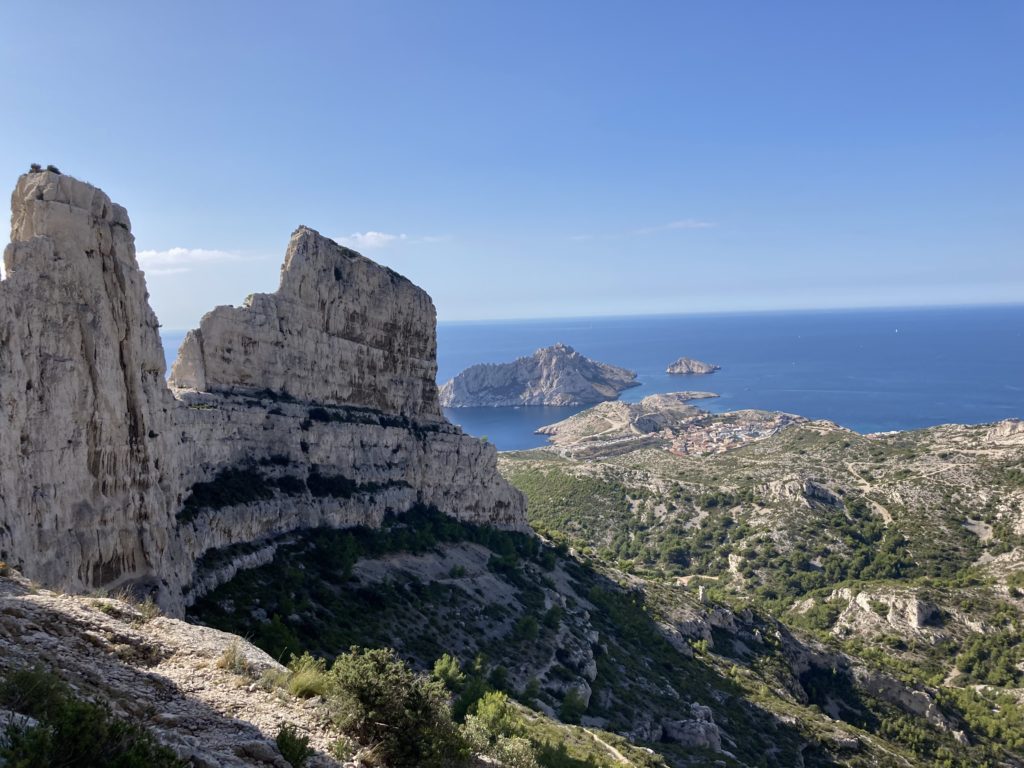
3. Passing through the Croix de Marseilleveyre from Pastré – about 2 hours one way
Be careful, it’s strong.
From the Park of Pastré, you will be on the highest point with a view of Marseille, the islands, Cassis …
You have to cross the park of Pastré and follow the markings.
There are many rather vertiginous passages so if you are not used to hiking or if you are prone to vertigo this path is probably not the best for you.
There are nice passages with the crossing of a cave and the view at the cross of Marseilleveyre is breathtaking.


How to get to the calanque de Marseilleveyre by bus?
If you are without a car, do not panic, there are buses!
From the city center (Castellane) you can take buses 19 and 20.
- Bus 19 – Castellane → Madrague de Montredon : 30-50 min (26 stops)
- Bus 20 – Madrague de Montredon → Callelongue : 10-30 min (7 stops)
With a single ticket, you can make the connection.
Tickets cost 2€ on the bus otherwise, you can buy a book of 10 in a metro station (15€ for 10 trips). Tickets are therefore cheaper.
Depending on the time of year, there are more or less buses and they are more or less full.
from May/June until September there are people plan to leave early.
In summer, buses make Prado – red point via line 19B and 19T so you can come by metro to the Prado it’s more tedious.
How to access the creek of Marseilleveyre by bike?
If you have your bike, you can go directly to Callelongue.
You will find places to leave your bike.
If you use the public network with bicycles at the terminals (“LeVélo”), the last terminal is at Pastré Park. But there are few places. If you manage to leave your bike you can hike to marseilleveyre through the Col de Marseilleveyre which is longer (at least an hour and a half more)
How to access the calanque de Marseilleveyre by car?
The Calanque de Marseilleveyre is the first calanque you will find from Marseille. From the city center (Castellane) it takes about 30 minutes if there is no traffic.
However, during traffic schedules or during the tourist season in summer you can easily take 2 times longer and especially not find places.
From May, on sunny days or during holidays, we recommend that you be on site before 9am!
Where to park at the calanque de Marseilleveyre?
You can park in Callelongue or at the Goudes car park.
Be careful, however, there are very few spaces, the car parks will be full very quickly in the morning during the summer or on sunny weekends.
How to access the creek of Marseilleveyre by boat?
During the summer (From April 23, 2022 to September 25), the city of Marseille sets up a network of boats making the estaque – Old port – Pointe rouge – les Goudes junction.
It takes about 20-25 minutes but there is usually a lot of queue during the day. The price is 5€ in addition to the price of a ticket. If you have a bus pass, you won’t have to pay extra.
Then you can walk to Pastré to go through the cross of Marseilleveyre or take bus 19 and then 20.
This option allows you to avoid traffic jams on weekends but there are a lot of people.
For schedules:
- From the Old Port: from 8am to 7pm (departures every hour)
- From Pointe Rouge: from 7am to 7pm (departures every hour)
3 additional slots from 20:00 to 22:00 from June 25 to August 28
For more information the site Navette Marseille RTM network
How to get to the Belgian Marseilleveyre?
To find the famous bar “Le Belge” you have to walk to the Calanque de Marseilleveyre. After a good walk you can enjoy a friendly moment around a cold drink.
Be careful, you will not find drinking water to fill your bottles or toilets. So you can buy a bottle of water or have a drink from the reserve of available stocks
Which creeks to visit in Marseille?
From Marseille to La Ciotat via Cassis, you will find a large number of creeks to discover the charms of the region.
The creeks of Marseille go globally from Carry le rouet to Cassis:
Creeks of the Blue Coast
- Calanque du Cap Rousset (in Carry-le-Rouet)
- Saltwater cove here
- Calanque d’Ensuès-la-Redonne here (La Redonne-Ensuès)
- Calanque des Anthénors ici (La Redonne-Ensuès)
- Calanque des Figuières here
- Calanque de Méjean here
- Calanque de l’Erevine here
- Calanque de la Vesse (Port de la Vesse – Niolon) here
Creeks on the Pointe Rouge side:
- Calanque de Marseilleveyre (Departure Callelongue) here
- Calanque des Queyrons here
- Calanque de Podestat here
- Calanque de l’Escu here
Calanques de Luminy:
Calanques de Cassis:
Calanques de la Ciotat:
Walks in the creeks of Marseille:
- From Niolon to Carry le Rouet: The customs trail or Niolon trail here
Rate the article
If you liked this article, please rate it 5 in support 🙂
Follow our adventures
Feel free to comment or join us on Instagram @jeanmichelvoyage


Discover our other Roadtrips:
- Roadtrip in Italy
- Roadtrip in Bolivia and Peru
- Roadtrip in Senegal
- Guinea Bissau Roadtrip
- Tenerife Roadtrip
- Panama Roadtrip
Tell us in comments your questions or share your experience!